
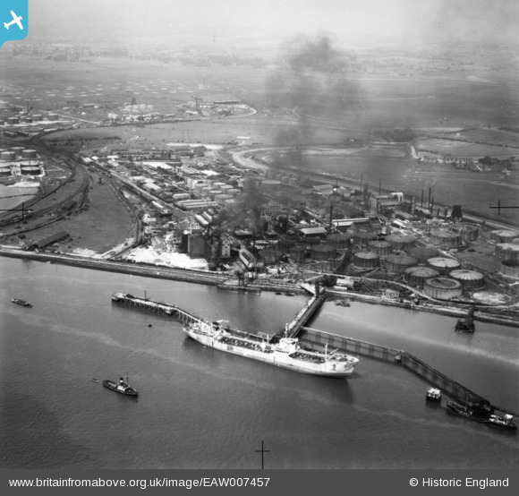
EAW007457 ENGLAND (1947). Part of the Coryton Oil Refinery complex, Coryton, from the south-east, 1947. This image has been produced from a print.
© Hawlfraint cyfranwyr OpenStreetMap a thrwyddedwyd gan yr OpenStreetMap Foundation. 2026. Trwyddedir y gartograffeg fel CC BY-SA.
Delweddau cyfagos (8)
EAW007457

EAW007462

EAW007464

EAW007453

EAW007461

EAW007451

EAW007456

EAW043879

Manylion
| Pennawd | [EAW007457] Part of the Coryton Oil Refinery complex, Coryton, from the south-east, 1947. This image has been produced from a print. |
| Cyfeirnod | EAW007457 |
| Dyddiad | 25-June-1947 |
| Dolen | |
| Enw lle | CORYTON |
| Plwyf | |
| Ardal | |
| Gwlad | ENGLAND |
| Dwyreiniad / Gogleddiad | 574619, 181614 |
| Hydred / Lledred | 0.51641320194523, 51.505956497081 |
| Cyfeirnod Grid Cenedlaethol | TQ746816 |
Pinnau
Byddwch y cyntaf i ychwanegu sylw at y ddelwedd hon!