
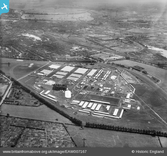
EAW007167 ENGLAND (1947). The Royal Agricultural Show Ground at West Common and environs, Lincoln, 1947
© Hawlfraint cyfranwyr OpenStreetMap a thrwyddedwyd gan yr OpenStreetMap Foundation. 2026. Trwyddedir y gartograffeg fel CC BY-SA.
Delweddau cyfagos (10)
EAW007167

EAW007170

EAW007181

EAW007174

EAW007176

EAW007173

EAW007177

EAW007185

EAW007169

EAW007172

Manylion
| Pennawd | [EAW007167] The Royal Agricultural Show Ground at West Common and environs, Lincoln, 1947 |
| Cyfeirnod | EAW007167 |
| Dyddiad | 25-June-1947 |
| Dolen | |
| Enw lle | LINCOLN |
| Plwyf | |
| Ardal | |
| Gwlad | ENGLAND |
| Dwyreiniad / Gogleddiad | 496231, 372040 |
| Hydred / Lledred | -0.55800975876543, 53.236379300744 |
| Cyfeirnod Grid Cenedlaethol | SK962720 |
Pinnau

redmist |
Tuesday 30th of July 2019 01:09:15 PM |