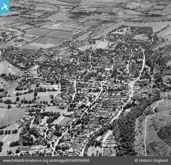
EAW006886 ENGLAND (1947). The town, Great Malvern, 1947
    © Hawlfraint cyfranwyr OpenStreetMap a thrwyddedwyd gan yr OpenStreetMap Foundation. 2025. Trwyddedir y gartograffeg fel CC BY-SA.
  
Delweddau cyfagos (6)
Manylion
| Pennawd | [EAW006886] The town, Great Malvern, 1947 | 
| Cyfeirnod | EAW006886 | 
| Dyddiad | 10-July-1947 | 
| Dolen | |
| Enw lle | GREAT MALVERN | 
| Plwyf | MALVERN | 
| Ardal | |
| Gwlad | ENGLAND | 
| Dwyreiniad / Gogleddiad | 377819, 245926 | 
| Hydred / Lledred | -2.3239319847866, 52.110802230433 | 
| Cyfeirnod Grid Cenedlaethol | SO778459 | 
Pinnau
|  Standby generator building (1 of 2) later became the tin bashers workshop, printed circuit board production facility and more. |   HughW | Tuesday 10th of June 2014 02:11:48 AM | 
|  Guard lodge for HMS Duke / TRE / RRE etc |   HughW | Tuesday 10th of June 2014 02:09:00 AM | 
|  Originally the staff canteen from HMS Duke, then occupied by the Ministry of Public Buliding and Works (later renamed the PSA). Later still became W building and housed amongst other things the wiring shops, test gear repair. |   HughW | Tuesday 10th of June 2014 02:07:46 AM | 
|  Originally the Officers Mess for HMS Duke - converted into a staff canteen when TRE moved in. |   HughW | Tuesday 10th of June 2014 02:04:55 AM | 
|  Nelson Hall - originally the drill hall from HMS Duke. Converted into a conference facility by TRE. A new stage was built where the TRE Theatrical Socient put on plays - they were later to become the Nelson Players. |   HughW | Tuesday 10th of June 2014 02:01:32 AM | 
|  Geraldine Hostel - built in 1943 (mainly) to house the workers from the Telecommunications Research Establishment Engineering Unit. Later used to house the scientific staff who had to move out of Malvern College when TRE moved down the the HMS Duke site in St Andrews Road. Then from 1948 onwards the apprentices moved in. |   HughW | Saturday 24th of May 2014 09:45:34 PM | 
|  E Block RSRE |   BobE | Monday 3rd of March 2014 11:03:45 AM | 
|  G Block RSRE |   BobE | Monday 3rd of March 2014 11:02:53 AM | 
|  C Block RSRE |   BobE | Monday 3rd of March 2014 11:02:19 AM | 
|  F Block RSRE |   BobE | Monday 3rd of March 2014 11:01:44 AM | 
|  D Block RSRE |   BobE | Monday 3rd of March 2014 11:01:00 AM | 
|  B Block RSRE |   BobE | Monday 3rd of March 2014 11:00:23 AM | 
|  A Block RSRE |   BobE | Monday 3rd of March 2014 10:59:45 AM | 
|  Malvern Wells (GW) railway station |   MB | Monday 11th of November 2013 06:25:27 PM | 
|  Peachfield Road |   MB | Monday 11th of November 2013 06:24:41 PM | 
|  Great Western Railway to Ledbury and Hereford |   MB | Monday 11th of November 2013 06:19:31 PM | 
|  Ex Midland Railway branch line to Upton-on-Severn, Tewkesbury and Ashchurch |   MB | Monday 11th of November 2013 06:18:50 PM | 
|  Now a golf course |   MB | Monday 11th of November 2013 06:17:11 PM | 
|  Engine shed. At SO781449. Apparently of timber and closed in 1931. Yard was in use until at least 1940. Locomotive turntable also visible |   MB | Monday 11th of November 2013 06:16:43 PM | 
|  Military camp? |   MB | Monday 11th of November 2013 06:06:43 PM | 
|  Railway station |   MB | Monday 11th of November 2013 06:02:48 PM | 
 
             
  ![[EAW006886] The town, Great Malvern, 1947](http://britainfromabove.org.uk/sites/all/libraries/aerofilms-images/public/100x100/EAW/006/EAW006886.jpg) 
  
                                          ![[EPW033914] The town centre, Great Malvern, 1930](http://britainfromabove.org.uk/sites/all/libraries/aerofilms-images/public/100x100/EPW/033/EPW033914.jpg) 
 ![[EAW023739] Hillstone School, Graham Road and environs, Great Malvern, 1949. This image was marked by Aerofilms Ltd for photo editing.](http://britainfromabove.org.uk/sites/all/libraries/aerofilms-images/public/100x100/EAW/023/EAW023739.jpg) 
 ![[EPW006028] The Priory Church of St Mary and St Michael, Great Malvern, 1921. This image has been produced from a copy-negative.](http://britainfromabove.org.uk/sites/all/libraries/aerofilms-images/public/100x100/EPW/006/EPW006028.jpg) 
 ![[EPW005393] The Priory Church of St Mary and St Michael, Great Malvern, 1921](http://britainfromabove.org.uk/sites/all/libraries/aerofilms-images/public/100x100/EPW/005/EPW005393.jpg) 
 ![[EPW033927] The town centre overlooked by Green Valley and Sugarloaf Hill, Great Malvern, 1930](http://britainfromabove.org.uk/sites/all/libraries/aerofilms-images/public/100x100/EPW/033/EPW033927.jpg)