
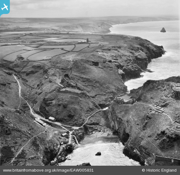
EAW005831 ENGLAND (1947). Archaeological remains on The Island and mainland looking towards the Church of St Materiana, Tintagel, from the north, 1947
© Hawlfraint cyfranwyr OpenStreetMap a thrwyddedwyd gan yr OpenStreetMap Foundation. 2026. Trwyddedir y gartograffeg fel CC BY-SA.
Delweddau cyfagos (16)
EAW005831

EAW005829

EAW031045

EAW031019

EAW031042

EAW031044

EAW031015

EAW005833

EAW005828

EAW005832

EAW031043

EAW005830

EAW031013

EAW031046

EAW020264

EAW031041

Manylion
| Pennawd | [EAW005831] Archaeological remains on The Island and mainland looking towards the Church of St Materiana, Tintagel, from the north, 1947 |
| Cyfeirnod | EAW005831 |
| Dyddiad | 18-May-1947 |
| Dolen | |
| Enw lle | TINTAGEL |
| Plwyf | TINTAGEL |
| Ardal | |
| Gwlad | ENGLAND |
| Dwyreiniad / Gogleddiad | 205135, 88989 |
| Hydred / Lledred | -4.7578592872979, 50.667331299105 |
| Cyfeirnod Grid Cenedlaethol | SX051890 |
