
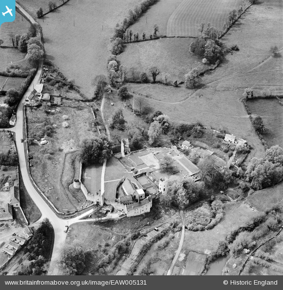
EAW005131 ENGLAND (1947). Farleigh Castle, Farleigh Hungerford, 1947
© Hawlfraint cyfranwyr OpenStreetMap a thrwyddedwyd gan yr OpenStreetMap Foundation. 2025. Trwyddedir y gartograffeg fel CC BY-SA.
Delweddau cyfagos (6)
EAW005131

EAW005130

EAW005132

EAW005129

EAW005134

EAW005133

Manylion
| Pennawd | [EAW005131] Farleigh Castle, Farleigh Hungerford, 1947 |
| Cyfeirnod | EAW005131 |
| Dyddiad | 7-September-1947 |
| Dolen | |
| Enw lle | FARLEIGH HUNGERFORD |
| Plwyf | NORTON ST. PHILIP |
| Ardal | |
| Gwlad | ENGLAND |
| Dwyreiniad / Gogleddiad | 380031, 157644 |
| Hydred / Lledred | -2.2865669235304, 51.317049123051 |
| Cyfeirnod Grid Cenedlaethol | ST800576 |
Pinnau

totoro |
Sunday 6th of October 2013 09:26:20 PM | |
|
totoro |
Sunday 6th of October 2013 09:23:42 PM | |
|
totoro |
Sunday 6th of October 2013 09:14:15 PM | |
|
totoro |
Sunday 6th of October 2013 09:14:15 PM | |
|
totoro |
Sunday 6th of October 2013 09:12:37 PM | |
|
totoro |
Sunday 6th of October 2013 09:11:48 PM | |
|
totoro |
Sunday 6th of October 2013 09:11:09 PM | |
|
totoro |
Sunday 6th of October 2013 09:10:29 PM | |
|
totoro |
Sunday 6th of October 2013 09:09:53 PM | |
|
totoro |
Sunday 6th of October 2013 09:08:44 PM | |
|
totoro |
Sunday 6th of October 2013 09:08:11 PM | |
|
totoro |
Sunday 6th of October 2013 09:07:16 PM |