
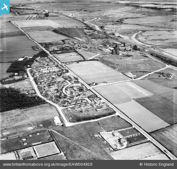
EAW004819 ENGLAND (1947). Hersden village and Chislet Colliery, Hersden, 1947
© Hawlfraint cyfranwyr OpenStreetMap a thrwyddedwyd gan yr OpenStreetMap Foundation. 2026. Trwyddedir y gartograffeg fel CC BY-SA.
Delweddau cyfagos (3)
EAW004819

EAW004822

EAW004821

Manylion
| Pennawd | [EAW004819] Hersden village and Chislet Colliery, Hersden, 1947 |
| Cyfeirnod | EAW004819 |
| Dyddiad | 25-April-1947 |
| Dolen | |
| Enw lle | HERSDEN |
| Plwyf | STURRY |
| Ardal | |
| Gwlad | ENGLAND |
| Dwyreiniad / Gogleddiad | 620476, 162038 |
| Hydred / Lledred | 1.1641097635212, 51.31416044298 |
| Cyfeirnod Grid Cenedlaethol | TR205620 |
Pinnau

Sparky |
Friday 6th of October 2017 06:27:18 PM | |

Kent Boy |
Saturday 2nd of August 2014 11:32:31 PM | |
|
totoro |
Friday 18th of October 2013 02:55:16 PM | |
|
totoro |
Friday 18th of October 2013 02:55:01 PM | |
|
totoro |
Friday 18th of October 2013 02:54:25 PM | |
|
totoro |
Friday 18th of October 2013 02:53:40 PM | |
|
totoro |
Friday 18th of October 2013 02:53:16 PM | |
|
totoro |
Friday 18th of October 2013 02:51:13 PM | |
|
totoro |
Friday 18th of October 2013 02:50:52 PM | |
|
totoro |
Friday 18th of October 2013 02:43:47 PM | |
And Grove Ferry between. |
John Wass |
Friday 17th of April 2015 09:17:49 PM |
|
totoro |
Friday 18th of October 2013 02:42:22 PM | |
|
totoro |
Friday 18th of October 2013 02:41:29 PM | |
|
totoro |
Friday 18th of October 2013 02:39:57 PM |