
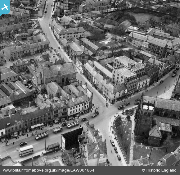
EAW004664 ENGLAND (1947). The junction of Curzon Street and Wardwick, Derby, 1947
© Hawlfraint cyfranwyr OpenStreetMap a thrwyddedwyd gan yr OpenStreetMap Foundation. 2026. Trwyddedir y gartograffeg fel CC BY-SA.
Delweddau cyfagos (6)
EAW004664

EPW005816

EAW004662

EPW055024

EAW044086

EAW004663

Manylion
| Pennawd | [EAW004664] The junction of Curzon Street and Wardwick, Derby, 1947 |
| Cyfeirnod | EAW004664 |
| Dyddiad | 22-April-1947 |
| Dolen | |
| Enw lle | DERBY |
| Plwyf | |
| Ardal | |
| Gwlad | ENGLAND |
| Dwyreiniad / Gogleddiad | 434951, 336268 |
| Hydred / Lledred | -1.4800811812326, 52.922370241124 |
| Cyfeirnod Grid Cenedlaethol | SK350363 |
Pinnau

Triggy |
Tuesday 2nd of June 2015 06:49:13 PM | |
|
Maitland |
Monday 1st of June 2015 08:38:22 PM | |

melgibbs |
Saturday 15th of February 2014 07:06:12 PM | |
|
melgibbs |
Saturday 15th of February 2014 07:03:17 PM | |
|
melgibbs |
Saturday 15th of February 2014 07:02:51 PM | |
|
melgibbs |
Saturday 15th of February 2014 07:01:34 PM | |
|
melgibbs |
Saturday 15th of February 2014 06:59:41 PM | |
|
melgibbs |
Saturday 15th of February 2014 06:55:51 PM |