
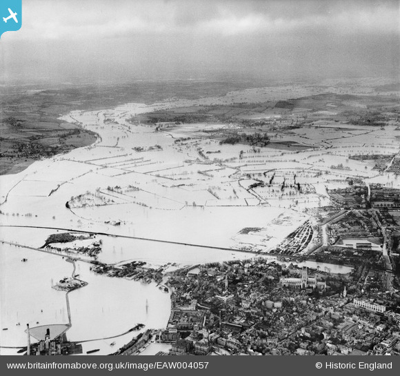
EAW004057 ENGLAND (1947). Flooding along the River Severn, Gloucester, from south, 1947
© Hawlfraint cyfranwyr OpenStreetMap a thrwyddedwyd gan yr OpenStreetMap Foundation. 2026. Trwyddedir y gartograffeg fel CC BY-SA.
Delweddau cyfagos (2)
EAW004057

EPW038352

Manylion
| Pennawd | [EAW004057] Flooding along the River Severn, Gloucester, from south, 1947 |
| Cyfeirnod | EAW004057 |
| Dyddiad | 21-March-1947 |
| Dolen | |
| Enw lle | GLOUCESTER |
| Plwyf | |
| Ardal | |
| Gwlad | ENGLAND |
| Dwyreiniad / Gogleddiad | 382667, 219292 |
| Hydred / Lledred | -2.251785719275, 51.871491427321 |
| Cyfeirnod Grid Cenedlaethol | SO827193 |
Pinnau
Byddwch y cyntaf i ychwanegu sylw at y ddelwedd hon!