
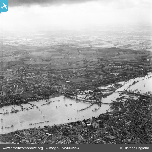
EAW003994 ENGLAND (1947). Flooding along the River Severn around Worcester Bridge and the County Cricket Ground, Worcester, from the east, 1947
© Hawlfraint cyfranwyr OpenStreetMap a thrwyddedwyd gan yr OpenStreetMap Foundation. 2026. Trwyddedir y gartograffeg fel CC BY-SA.
Delweddau cyfagos (6)
EAW003994

EAW023848

EAW023845

EPW000203

EPW001336

EAW023847

Manylion
| Pennawd | [EAW003994] Flooding along the River Severn around Worcester Bridge and the County Cricket Ground, Worcester, from the east, 1947 |
| Cyfeirnod | EAW003994 |
| Dyddiad | 21-March-1947 |
| Dolen | |
| Enw lle | WORCESTER |
| Plwyf | |
| Ardal | |
| Gwlad | ENGLAND |
| Dwyreiniad / Gogleddiad | 384431, 254595 |
| Hydred / Lledred | -2.2277685408411, 52.188974756398 |
| Cyfeirnod Grid Cenedlaethol | SO844546 |
Pinnau
Byddwch y cyntaf i ychwanegu sylw at y ddelwedd hon!