
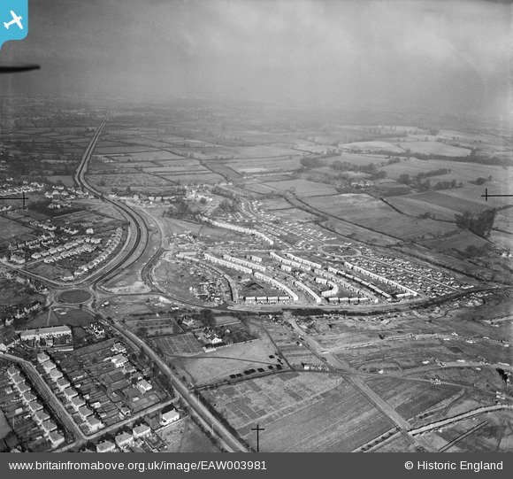
EAW003981 ENGLAND (1947). Prefabricated housing at Barton and environs, Barton, from the south-east, 1947
© Hawlfraint cyfranwyr OpenStreetMap a thrwyddedwyd gan yr OpenStreetMap Foundation. 2026. Trwyddedir y gartograffeg fel CC BY-SA.
Delweddau cyfagos (3)
EAW003981

EAW003876

EAW003877

Manylion
| Pennawd | [EAW003981] Prefabricated housing at Barton and environs, Barton, from the south-east, 1947 |
| Cyfeirnod | EAW003981 |
| Dyddiad | 20-March-1947 |
| Dolen | |
| Enw lle | BARTON |
| Plwyf | |
| Ardal | |
| Gwlad | ENGLAND |
| Dwyreiniad / Gogleddiad | 455775, 207486 |
| Hydred / Lledred | -1.1917322268525, 51.762822373496 |
| Cyfeirnod Grid Cenedlaethol | SP558075 |
Pinnau
Byddwch y cyntaf i ychwanegu sylw at y ddelwedd hon!