
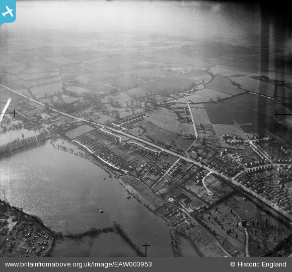
EAW003953 ENGLAND (1947). The Southern Bypass Road and flooding by North Hinksey Lane, North Hinksey Village, from the north, 1947
© Hawlfraint cyfranwyr OpenStreetMap a thrwyddedwyd gan yr OpenStreetMap Foundation. 2026. Trwyddedir y gartograffeg fel CC BY-SA.
Delweddau cyfagos (2)
EAW003953

EAW003977

Manylion
| Pennawd | [EAW003953] The Southern Bypass Road and flooding by North Hinksey Lane, North Hinksey Village, from the north, 1947 |
| Cyfeirnod | EAW003953 |
| Dyddiad | 20-March-1947 |
| Dolen | |
| Enw lle | NORTH HINKSEY VILLAGE |
| Plwyf | NORTH HINKSEY |
| Ardal | |
| Gwlad | ENGLAND |
| Dwyreiniad / Gogleddiad | 449114, 205839 |
| Hydred / Lledred | -1.2884848298618, 51.74863753725 |
| Cyfeirnod Grid Cenedlaethol | SP491058 |
Pinnau

David Brimson |
Wednesday 31st of January 2024 06:18:09 PM | |
|
David Brimson |
Wednesday 31st of January 2024 06:17:27 PM |