
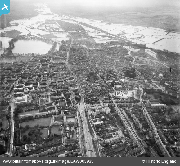
EAW003935 ENGLAND (1947). The city centre and flooding at Christ Church Meadow and Grandpont, Oxford, from the north, 1947
© Hawlfraint cyfranwyr OpenStreetMap a thrwyddedwyd gan yr OpenStreetMap Foundation. 2026. Trwyddedir y gartograffeg fel CC BY-SA.
Delweddau cyfagos (14)
EAW003935

EPW038410

EAW045715

EPW022529

EAW045710

EAW003115

EAW003116

EPW038409

EAW003114

EPW000819

EAW045716

EAW003118

EPW024628

EPW022523

Manylion
| Pennawd | [EAW003935] The city centre and flooding at Christ Church Meadow and Grandpont, Oxford, from the north, 1947 |
| Cyfeirnod | EAW003935 |
| Dyddiad | 20-March-1947 |
| Dolen | |
| Enw lle | OXFORD |
| Plwyf | |
| Ardal | |
| Gwlad | ENGLAND |
| Dwyreiniad / Gogleddiad | 451197, 206619 |
| Hydred / Lledred | -1.2581961629904, 51.755464272114 |
| Cyfeirnod Grid Cenedlaethol | SP512066 |
