
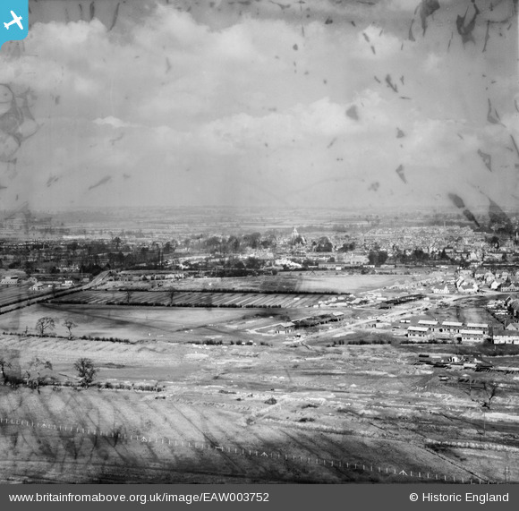
EAW003752 ENGLAND (1947). Construction of housing and roads at the Southcourt Estate, Aylesbury, from the south-west, 1947. This image has been produced from a damaged negative.
© Hawlfraint cyfranwyr OpenStreetMap a thrwyddedwyd gan yr OpenStreetMap Foundation. 2026. Trwyddedir y gartograffeg fel CC BY-SA.
Delweddau cyfagos (6)
EAW003752

EAW003751

EAW004152

EAW003749

EAW003753

EAW003750

Manylion
| Pennawd | [EAW003752] Construction of housing and roads at the Southcourt Estate, Aylesbury, from the south-west, 1947. This image has been produced from a damaged negative. |
| Cyfeirnod | EAW003752 |
| Dyddiad | 18-March-1947 |
| Dolen | |
| Enw lle | AYLESBURY |
| Plwyf | AYLESBURY |
| Ardal | |
| Gwlad | ENGLAND |
| Dwyreiniad / Gogleddiad | 481150, 213085 |
| Hydred / Lledred | -0.82276925624433, 51.81005528723 |
| Cyfeirnod Grid Cenedlaethol | SP812131 |
Pinnau
Byddwch y cyntaf i ychwanegu sylw at y ddelwedd hon!