
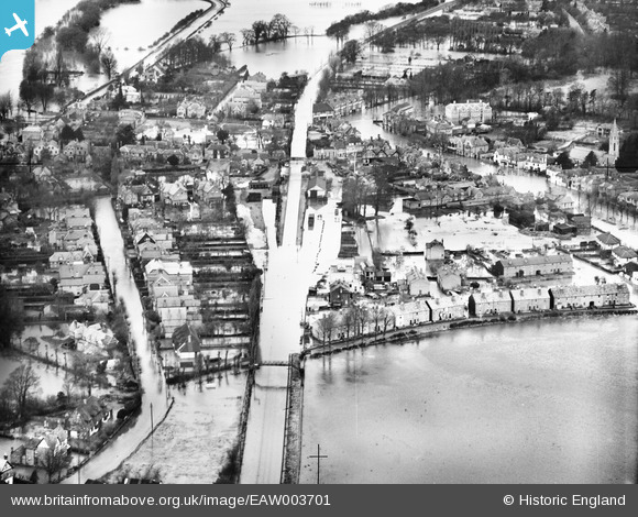
EAW003701 ENGLAND (1947). Flooding around Datchet Railway Station and The Green, Datchet, 1947
© Hawlfraint cyfranwyr OpenStreetMap a thrwyddedwyd gan yr OpenStreetMap Foundation. 2026. Trwyddedir y gartograffeg fel CC BY-SA.
Delweddau cyfagos (2)
EAW003701

EAW003698

Manylion
| Pennawd | [EAW003701] Flooding around Datchet Railway Station and The Green, Datchet, 1947 |
| Cyfeirnod | EAW003701 |
| Dyddiad | 18-March-1947 |
| Dolen | |
| Enw lle | DATCHET |
| Plwyf | DATCHET |
| Ardal | |
| Gwlad | ENGLAND |
| Dwyreiniad / Gogleddiad | 498808, 176907 |
| Hydred / Lledred | -0.57690637613854, 51.48199082651 |
| Cyfeirnod Grid Cenedlaethol | SU988769 |
Pinnau

AY |
Saturday 1st of November 2014 05:49:48 PM | |
Nonnymoose |
Monday 6th of October 2014 07:04:25 PM | |
Nonnymoose |
Monday 6th of October 2014 07:03:29 PM | |
Nonnymoose |
Monday 6th of October 2014 07:02:20 PM | |
|
Bazza |
Monday 3rd of February 2014 10:21:12 AM | |
|
dave43 |
Monday 9th of September 2013 10:30:03 PM | |
Not the Thames - this is the junction of Slough Road and High Street. |
Bazza |
Monday 3rd of February 2014 10:24:32 AM |
|
dave43 |
Monday 9th of September 2013 10:29:31 PM |