
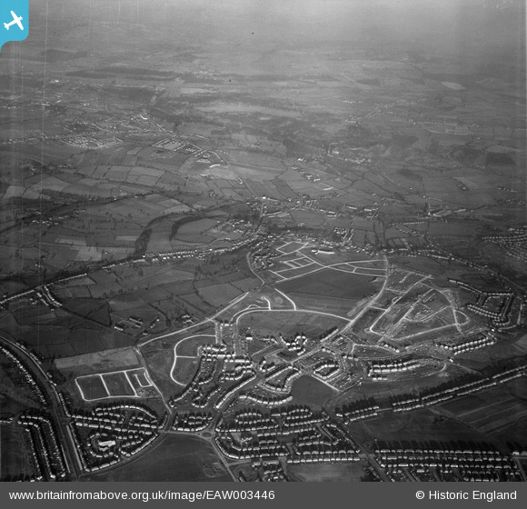
EAW003446 ENGLAND (1946). Housing estate under construction to the north of Deerlands Avenue, Parson Cross, from the south, 1946
© Hawlfraint cyfranwyr OpenStreetMap a thrwyddedwyd gan yr OpenStreetMap Foundation. 2026. Trwyddedir y gartograffeg fel CC BY-SA.
Delweddau cyfagos (4)
EAW003446

EAW003447

EAW003443

EAW003448

Manylion
| Pennawd | [EAW003446] Housing estate under construction to the north of Deerlands Avenue, Parson Cross, from the south, 1946 |
| Cyfeirnod | EAW003446 |
| Dyddiad | 4-December-1946 |
| Dolen | |
| Enw lle | PARSON CROSS |
| Plwyf | |
| Ardal | |
| Gwlad | ENGLAND |
| Dwyreiniad / Gogleddiad | 434900, 393220 |
| Hydred / Lledred | -1.4746212458438, 53.434347764671 |
| Cyfeirnod Grid Cenedlaethol | SK349932 |
Pinnau

martinmj |
Wednesday 13th of July 2022 10:22:28 PM | |
|
martinmj |
Wednesday 13th of July 2022 10:21:34 PM | |
|
redmist |
Thursday 17th of January 2019 11:06:56 PM | |
|
redmist |
Thursday 17th of January 2019 11:06:18 PM |