
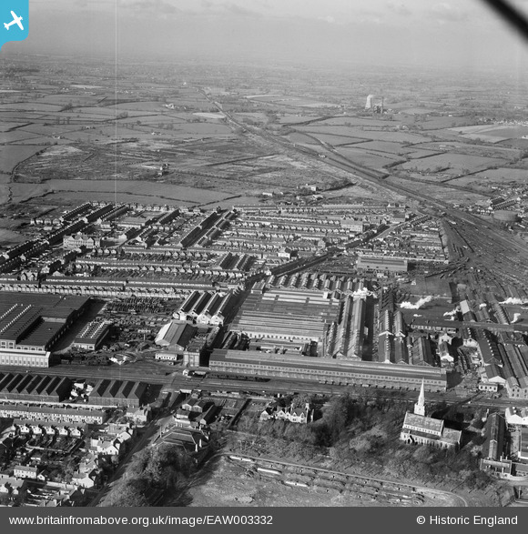
EAW003332 ENGLAND (1946). St Mark's Church, the Great Western Railway Works and environs, Swindon, from the south-east, 1946
© Hawlfraint cyfranwyr OpenStreetMap a thrwyddedwyd gan yr OpenStreetMap Foundation. 2026. Trwyddedir y gartograffeg fel CC BY-SA.
Delweddau cyfagos (2)
EAW003332

EAW003333

Manylion
| Pennawd | [EAW003332] St Mark's Church, the Great Western Railway Works and environs, Swindon, from the south-east, 1946 |
| Cyfeirnod | EAW003332 |
| Dyddiad | 13-November-1946 |
| Dolen | |
| Enw lle | SWINDON |
| Plwyf | |
| Ardal | |
| Gwlad | ENGLAND |
| Dwyreiniad / Gogleddiad | 414197, 184673 |
| Hydred / Lledred | -1.7951797650706, 51.560281963235 |
| Cyfeirnod Grid Cenedlaethol | SU142847 |
Pinnau

HBMil |
Tuesday 20th of January 2026 08:57:32 PM | |
|
NottmJas |
Sunday 17th of September 2023 12:20:10 AM | |
|
NottmJas |
Sunday 17th of September 2023 12:19:24 AM | |
|
NottmJas |
Sunday 17th of September 2023 12:18:48 AM | |
|
NottmJas |
Sunday 17th of September 2023 12:18:08 AM | |
|
NottmJas |
Sunday 17th of September 2023 12:17:34 AM | |

Class31 |
Tuesday 14th of January 2014 11:03:55 AM | |
|
Class31 |
Tuesday 14th of January 2014 10:51:28 AM | |
|
Class31 |
Tuesday 14th of January 2014 10:51:07 AM | |
|
Class31 |
Tuesday 14th of January 2014 10:50:41 AM | |
|
Class31 |
Tuesday 14th of January 2014 10:50:04 AM | |
|
Class31 |
Tuesday 14th of January 2014 10:49:45 AM |