
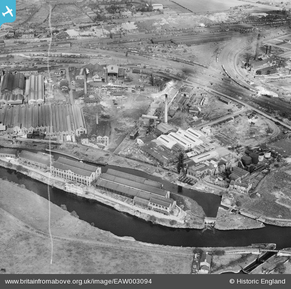
EAW003094 ENGLAND (1946). The Brotherton and Co Ammonia Works and Stennard Island, Wakefield, 1946. This image was marked by Aerofilms Ltd for photo editing.
© Hawlfraint cyfranwyr OpenStreetMap a thrwyddedwyd gan yr OpenStreetMap Foundation. 2026. Trwyddedir y gartograffeg fel CC BY-SA.
Delweddau cyfagos (16)
EAW003094

EAW003093

EAW003096

EAW003090

EAW003095

EAW003091

EPW032579

EPW032574

EAW003092

EAW002604

EPW032576

EAW002601

EAW002600

EAW002605

EAW002602

EAW003097

Manylion
| Pennawd | [EAW003094] The Brotherton and Co Ammonia Works and Stennard Island, Wakefield, 1946. This image was marked by Aerofilms Ltd for photo editing. |
| Cyfeirnod | EAW003094 |
| Dyddiad | 11-October-1946 |
| Dolen | |
| Enw lle | WAKEFIELD |
| Plwyf | |
| Ardal | |
| Gwlad | ENGLAND |
| Dwyreiniad / Gogleddiad | 434235, 420043 |
| Hydred / Lledred | -1.4816932852118, 53.675503662378 |
| Cyfeirnod Grid Cenedlaethol | SE342200 |
