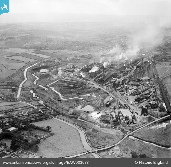
EAW003073 ENGLAND (1946). The Devonshire Works and environs, Staveley, from the east, 1946
© Hawlfraint cyfranwyr OpenStreetMap a thrwyddedwyd gan yr OpenStreetMap Foundation. 2026. Trwyddedir y gartograffeg fel CC BY-SA.
Delweddau cyfagos (5)
Manylion
| Pennawd | [EAW003073] The Devonshire Works and environs, Staveley, from the east, 1946 |
| Cyfeirnod | EAW003073 |
| Dyddiad | 8-October-1946 |
| Dolen | |
| Enw lle | STAVELEY |
| Plwyf | STAVELEY |
| Ardal | |
| Gwlad | ENGLAND |
| Dwyreiniad / Gogleddiad | 443098, 374985 |
| Hydred / Lledred | -1.3537020077046, 53.269824842853 |
| Cyfeirnod Grid Cenedlaethol | SK431750 |


![[EAW003073] The Devonshire Works and environs, Staveley, from the east, 1946](http://britainfromabove.org.uk/sites/all/libraries/aerofilms-images/public/100x100/EAW/003/EAW003073.jpg)
![[EPW057349] The town and environs, Staveley, 1938](http://britainfromabove.org.uk/sites/all/libraries/aerofilms-images/public/100x100/EPW/057/EPW057349.jpg)
![[EPW041675] The Devonshire Iron and Chemical Works, Staveley, 1933](http://britainfromabove.org.uk/sites/all/libraries/aerofilms-images/public/100x100/EPW/041/EPW041675.jpg)
![[EAW003071] The Devonshire Works, Staveley, 1946](http://britainfromabove.org.uk/sites/all/libraries/aerofilms-images/public/100x100/EAW/003/EAW003071.jpg)
![[EAW044347] The town looking towards Hall Lane Junction, Staveley, from the south, 1952](http://britainfromabove.org.uk/sites/all/libraries/aerofilms-images/public/100x100/EAW/044/EAW044347.jpg)
