
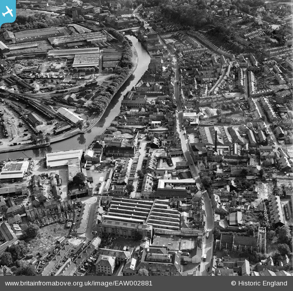
EAW002881 ENGLAND (1946). The Morgans Old Brewery off King Street, the River Wensum and the surrounding area, Norwich, 1946
© Hawlfraint cyfranwyr OpenStreetMap a thrwyddedwyd gan yr OpenStreetMap Foundation. 2026. Trwyddedir y gartograffeg fel CC BY-SA.
Delweddau cyfagos (9)
EAW002881

EAW002885

EAW002882

EAW002883

EAW002878

EAW002880

EAW002884

EAW002879

EPW001970

Manylion
| Pennawd | [EAW002881] The Morgans Old Brewery off King Street, the River Wensum and the surrounding area, Norwich, 1946 |
| Cyfeirnod | EAW002881 |
| Dyddiad | 1-October-1946 |
| Dolen | |
| Enw lle | NORWICH |
| Plwyf | |
| Ardal | |
| Gwlad | ENGLAND |
| Dwyreiniad / Gogleddiad | 623558, 308232 |
| Hydred / Lledred | 1.3034824734594, 52.625380239507 |
| Cyfeirnod Grid Cenedlaethol | TG236082 |
Pinnau

fatty28uk |
Monday 24th of February 2014 07:19:54 PM | |
|
fatty28uk |
Monday 24th of February 2014 07:19:02 PM | |
|
fatty28uk |
Monday 24th of February 2014 07:13:10 PM | |
|
fatty28uk |
Monday 24th of February 2014 07:10:48 PM | |
|
fatty28uk |
Monday 24th of February 2014 07:09:01 PM | |
|
fatty28uk |
Monday 24th of February 2014 07:08:20 PM | |
|
fatty28uk |
Monday 24th of February 2014 07:07:31 PM | |
|
fatty28uk |
Monday 24th of February 2014 07:06:01 PM |