
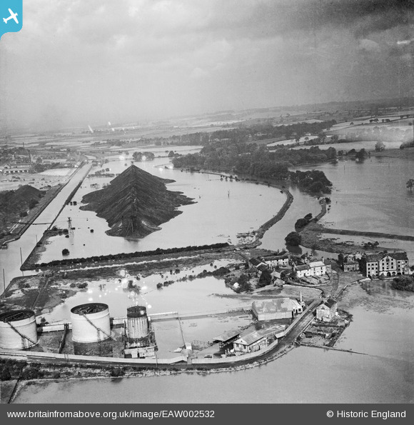
EAW002532 ENGLAND (1946). A spoil tip surrounded by flood waters between the Aire & Calder Navigation and the River Aire, Woodlesford, from the south-east, 1946
© Hawlfraint cyfranwyr OpenStreetMap a thrwyddedwyd gan yr OpenStreetMap Foundation. 2026. Trwyddedir y gartograffeg fel CC BY-SA.
Delweddau cyfagos (5)
EAW002532

EPW059457

EPW059458

EAW002552

EPW059459

Manylion
| Pennawd | [EAW002532] A spoil tip surrounded by flood waters between the Aire & Calder Navigation and the River Aire, Woodlesford, from the south-east, 1946 |
| Cyfeirnod | EAW002532 |
| Dyddiad | 21-September-1946 |
| Dolen | |
| Enw lle | WOODLESFORD |
| Plwyf | |
| Ardal | |
| Gwlad | ENGLAND |
| Dwyreiniad / Gogleddiad | 437916, 428534 |
| Hydred / Lledred | -1.4249270710225, 53.751572487993 |
| Cyfeirnod Grid Cenedlaethol | SE379285 |
Pinnau

Brick Collector |
Sunday 23rd of February 2014 09:30:06 PM | |
|
Brick Collector |
Sunday 23rd of February 2014 09:27:39 PM | |

Class31 |
Friday 6th of September 2013 06:41:54 AM | |
|
Class31 |
Friday 6th of September 2013 06:41:08 AM | |
|
Class31 |
Friday 6th of September 2013 06:40:49 AM |
Cyfraniadau Grŵp
A colliery waste tip made an island by floodwater. |
Class31 |
Friday 6th of September 2013 06:43:06 AM |