
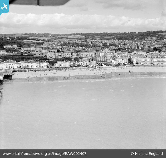
EAW002407 ENGLAND (1946). The town and seafront from the White Rock Pavilion to Carlisle Parade, Hastings, from the south-east, 1946
© Hawlfraint cyfranwyr OpenStreetMap a thrwyddedwyd gan yr OpenStreetMap Foundation. 2026. Trwyddedir y gartograffeg fel CC BY-SA.
Delweddau cyfagos (23)
EAW002407

EAW002406

EPW039390

EPW042839

EAW002408

EPW035339

EPW026200

EPW000060B

EAW022975

EAW030089

EPW035346

EPW042840

EPW035345

EPW026188

EPW035334

EPW039388

EAW006618

EAW002405

EPW044648

EPW026209

EPW000754

EPW039370

EPW039369

Manylion
| Pennawd | [EAW002407] The town and seafront from the White Rock Pavilion to Carlisle Parade, Hastings, from the south-east, 1946 |
| Cyfeirnod | EAW002407 |
| Dyddiad | 16-September-1946 |
| Dolen | |
| Enw lle | HASTINGS |
| Plwyf | |
| Ardal | |
| Gwlad | ENGLAND |
| Dwyreiniad / Gogleddiad | 581377, 109014 |
| Hydred / Lledred | 0.57704973159956, 50.851606199346 |
| Cyfeirnod Grid Cenedlaethol | TQ814090 |
Pinnau
Byddwch y cyntaf i ychwanegu sylw at y ddelwedd hon!