
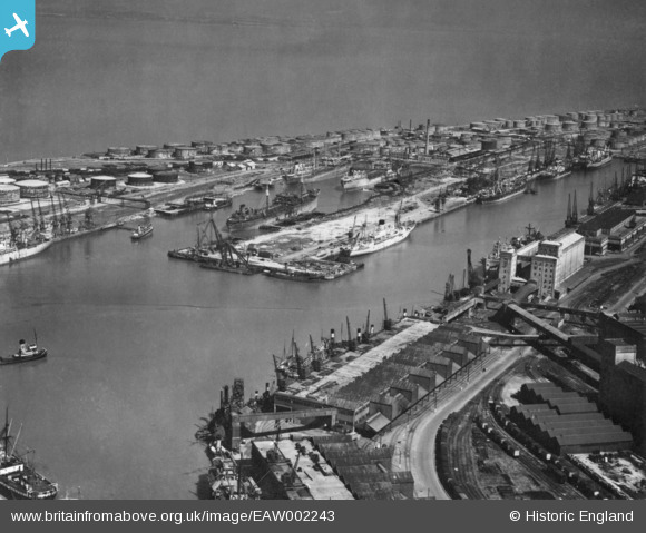
EAW002243 ENGLAND (1946). The Port of Bristol Authority Royal Edward Docks, Avonmouth, from the south, 1946. This image has been produced from a print.
© Hawlfraint cyfranwyr OpenStreetMap a thrwyddedwyd gan yr OpenStreetMap Foundation. 2026. Trwyddedir y gartograffeg fel CC BY-SA.
Delweddau cyfagos (20)
EAW002243

EPW005533

EPW019269

EAW002070

EPW005537

EPW005518

EAW002061

EPW027950

EPW005530

EAW002056

EPW008648

EPW044777

EPW005529

EPW044780

EPW046968

EPW044776

EPW014697

EPW044778

EPW046969

EPW005502

Manylion
| Pennawd | [EAW002243] The Port of Bristol Authority Royal Edward Docks, Avonmouth, from the south, 1946. This image has been produced from a print. |
| Cyfeirnod | EAW002243 |
| Dyddiad | 18-August-1946 |
| Dolen | |
| Enw lle | AVONMOUTH |
| Plwyf | |
| Ardal | |
| Gwlad | ENGLAND |
| Dwyreiniad / Gogleddiad | 351116, 178516 |
| Hydred / Lledred | -2.7043686281439, 51.502979351645 |
| Cyfeirnod Grid Cenedlaethol | ST511785 |
Pinnau

redmist |
Tuesday 10th of November 2020 11:43:19 PM | |
|
sloyne |
Friday 9th of February 2018 11:43:25 AM | |

Sparky |
Wednesday 13th of September 2017 07:29:18 PM |