
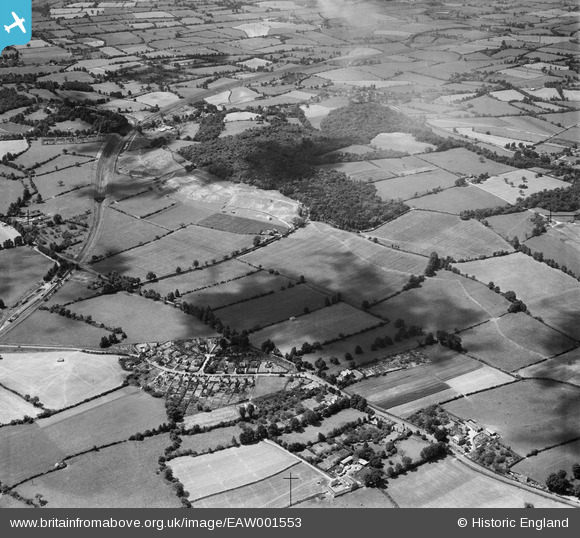
EAW001553 ENGLAND (1946). Housing at The Close, Haw Wood and the surrounding countryside, Catbrain, 1946
© Hawlfraint cyfranwyr OpenStreetMap a thrwyddedwyd gan yr OpenStreetMap Foundation. 2026. Trwyddedir y gartograffeg fel CC BY-SA.
Delweddau cyfagos (2)
EAW001553

EAW001546

Manylion
| Pennawd | [EAW001553] Housing at The Close, Haw Wood and the surrounding countryside, Catbrain, 1946 |
| Cyfeirnod | EAW001553 |
| Dyddiad | 15-July-1946 |
| Dolen | |
| Enw lle | CATBRAIN |
| Plwyf | ALMONDSBURY |
| Ardal | |
| Gwlad | ENGLAND |
| Dwyreiniad / Gogleddiad | 356577, 180134 |
| Hydred / Lledred | -2.6258858833574, 51.517974424114 |
| Cyfeirnod Grid Cenedlaethol | ST566801 |
Pinnau

Matt Aldred edob.mattaldred.com |
Monday 21st of November 2022 06:39:47 PM | |

Buzzard |
Tuesday 2nd of June 2015 11:36:53 PM | |
|
Buzzard |
Tuesday 2nd of June 2015 11:35:50 PM | |
|
Buzzard |
Tuesday 2nd of June 2015 11:34:13 PM | |
|
Buzzard |
Tuesday 2nd of June 2015 11:30:28 PM | |
|
Buzzard |
Tuesday 2nd of June 2015 11:29:36 PM | |
|
Buzzard |
Tuesday 2nd of June 2015 11:28:03 PM | |
|
Buzzard |
Tuesday 2nd of June 2015 11:25:53 PM | |
|
Buzzard |
Tuesday 2nd of June 2015 11:22:57 PM | |
|
Buzzard |
Tuesday 2nd of June 2015 11:22:07 PM | |
|
bristolian |
Wednesday 12th of November 2014 06:17:27 PM | |
|
NicTomkins |
Wednesday 1st of January 2014 03:31:46 PM | |
The image is 1946 so these tanks were built as part of the Air Ministry's distributed fuel depot network. Originally deliveries would have been by rail and lorry not pipeline. The depot was likely connected to the GPSS pipeline system in the 50's and used throughout the cold war into the 90's. The majority of these sites are now privately owned and operated by oil companies. |
cptpies |
Friday 10th of January 2014 09:29:10 AM |