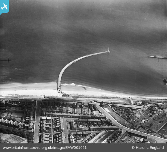
EAW001021 ENGLAND (1946). Roker Pier and Lighthouse, Sunderland, 1946
© Hawlfraint cyfranwyr OpenStreetMap a thrwyddedwyd gan yr OpenStreetMap Foundation. 2026. Trwyddedir y gartograffeg fel CC BY-SA.
Manylion
| Pennawd | [EAW001021] Roker Pier and Lighthouse, Sunderland, 1946 |
| Cyfeirnod | EAW001021 |
| Dyddiad | 6-June-1946 |
| Dolen | |
| Enw lle | SUNDERLAND |
| Plwyf | |
| Ardal | |
| Gwlad | ENGLAND |
| Dwyreiniad / Gogleddiad | 441146, 558786 |
| Hydred / Lledred | -1.3579558331265, 54.921987903049 |
| Cyfeirnod Grid Cenedlaethol | NZ411588 |
Pinnau

Matt Aldred edob.mattaldred.com |
Tuesday 12th of August 2025 12:01:36 PM | |

Matt Aldred edob.mattaldred.com |
Sunday 28th of February 2021 08:38:25 AM | |

redmist |
Thursday 24th of September 2020 08:16:25 PM | |

redmist |
Monday 17th of February 2020 05:03:32 PM | |

Coops |
Thursday 10th of March 2016 08:01:08 AM | |

Coops |
Thursday 10th of March 2016 08:00:35 AM | |

Coops |
Thursday 10th of March 2016 07:59:18 AM | |

Coops |
Thursday 10th of March 2016 07:57:59 AM | |

John Wass |
Wednesday 8th of April 2015 09:10:30 PM | |

Steve A |
Friday 23rd of August 2013 03:45:17 PM | |

Steve A |
Friday 23rd of August 2013 03:45:17 PM | |

Steve A |
Friday 23rd of August 2013 03:42:11 PM |


![[EAW001021] Roker Pier and Lighthouse, Sunderland, 1946](http://britainfromabove.org.uk/sites/all/libraries/aerofilms-images/public/100x100/EAW/001/EAW001021.jpg)
![[EPW051132] Roker Park and environs, Sunderland, from the south-east, 1936](http://britainfromabove.org.uk/sites/all/libraries/aerofilms-images/public/100x100/EPW/051/EPW051132.jpg)