
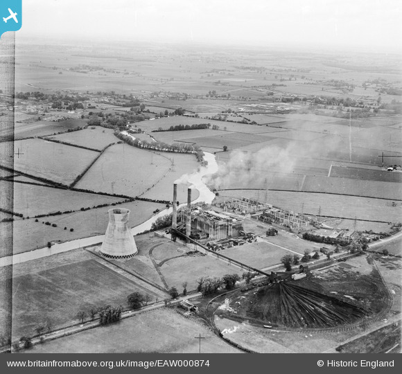
EAW000874 ENGLAND (1946). Little Barford Power Station and environs, Little Barford, from the south-east, 1946
© Hawlfraint cyfranwyr OpenStreetMap a thrwyddedwyd gan yr OpenStreetMap Foundation. 2026. Trwyddedir y gartograffeg fel CC BY-SA.
Delweddau cyfagos (11)
EAW000874

EAW000876

EAW000875

EAW003725

EAW000864

EAW000872

EAW000873

EAW000865

EAW000866

EAW000877

EAW000879

Manylion
| Pennawd | [EAW000874] Little Barford Power Station and environs, Little Barford, from the south-east, 1946 |
| Cyfeirnod | EAW000874 |
| Dyddiad | 31-May-1946 |
| Dolen | |
| Enw lle | LITTLE BARFORD |
| Plwyf | LITTLE BARFORD |
| Ardal | |
| Gwlad | ENGLAND |
| Dwyreiniad / Gogleddiad | 518255, 257680 |
| Hydred / Lledred | -0.26931740699007, 52.204241794944 |
| Cyfeirnod Grid Cenedlaethol | TL183577 |
Pinnau

Matt Aldred edob.mattaldred.com |
Sunday 10th of March 2024 11:18:35 AM | |
|
Matt Aldred edob.mattaldred.com |
Sunday 10th of March 2024 11:18:22 AM | |
|
Matt Aldred edob.mattaldred.com |
Sunday 10th of March 2024 11:18:10 AM | |
|
Matt Aldred edob.mattaldred.com |
Sunday 10th of March 2024 11:17:45 AM | |

redmist |
Thursday 11th of November 2021 10:15:00 PM | |
|
redmist |
Thursday 11th of November 2021 10:14:44 PM | |
|
redmist |
Thursday 11th of November 2021 10:13:43 PM | |

melgibbs |
Tuesday 21st of January 2014 08:41:41 PM | |
|
melgibbs |
Tuesday 21st of January 2014 08:41:03 PM |