
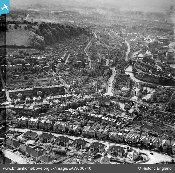
EAW000740 ENGLAND (1946). Widcombe and Beechen Cliff, Bath, from the east, 1946
© Hawlfraint cyfranwyr OpenStreetMap a thrwyddedwyd gan yr OpenStreetMap Foundation. 2026. Trwyddedir y gartograffeg fel CC BY-SA.
Delweddau cyfagos (2)
EAW000740

EAW000741

Manylion
| Pennawd | [EAW000740] Widcombe and Beechen Cliff, Bath, from the east, 1946 |
| Cyfeirnod | EAW000740 |
| Dyddiad | 9-May-1946 |
| Dolen | |
| Enw lle | BATH |
| Plwyf | |
| Ardal | |
| Gwlad | ENGLAND |
| Dwyreiniad / Gogleddiad | 375624, 164186 |
| Hydred / Lledred | -2.3502570032306, 51.375706747168 |
| Cyfeirnod Grid Cenedlaethol | ST756642 |
Pinnau

ClareH |
Wednesday 10th of September 2025 10:04:50 PM | |
|
ClareH |
Wednesday 10th of September 2025 10:03:27 PM | |

clippedwings |
Thursday 2nd of July 2015 10:07:26 AM | |
|
Bonzellee |
Thursday 2nd of July 2015 09:26:12 AM | |

Class31 |
Monday 11th of November 2013 10:05:57 AM | |
|
james348 |
Sunday 13th of October 2013 08:39:12 PM |