
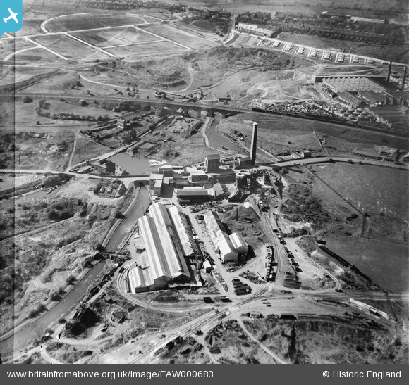
EAW000683 ENGLAND (1946). The Netherton Iron Works and the Parkhead Viaduct, Netherton, 1946. This image has been produced from a damaged negative.
© Hawlfraint cyfranwyr OpenStreetMap a thrwyddedwyd gan yr OpenStreetMap Foundation. 2026. Trwyddedir y gartograffeg fel CC BY-SA.
Delweddau cyfagos (37)
EAW000683

EPW046055

EPW046056

EAW024635

EAW024634

EAW024633

EPW046057

EAW024637

EAW024638

EAW024640

EPW046060

EPW046058

EPW046059

EPW046061

EAW024639

EAW000686

EAW024636

EAW000682

EAW000684

EAW000685

EAW041760
 Ltd Windmill Engineering Works, Dudley, 1952. This image has been produced from a damaged negative.")
EAW024641

EAW027691

EAW027698

EAW041766
 Ltd Windmill Engineering Works, Dudley, 1952. This image has been produced from a damaged negative.")
EAW027686

EAW027694

EAW027696

EAW027697

EAW041765
 Ltd Windmill Engineering Works, Dudley, 1952. This image has been produced from a damaged negative.")
EAW027687

EAW027693

EAW027692

EAW027690

EAW041762
 Ltd Windmill Engineering Works, Dudley, 1952. This image has been produced from a damaged negative.")
EAW041767
 Ltd Windmill Engineering Works, Dudley, 1952. This image has been produced from a damaged negative.")
EAW041769
 Ltd Windmill Engineering Works, Dudley, 1952. This image has been produced from a damaged negative.")
Manylion
| Pennawd | [EAW000683] The Netherton Iron Works and the Parkhead Viaduct, Netherton, 1946. This image has been produced from a damaged negative. |
| Cyfeirnod | EAW000683 |
| Dyddiad | 10-May-1946 |
| Dolen | |
| Enw lle | NETHERTON |
| Plwyf | |
| Ardal | |
| Gwlad | ENGLAND |
| Dwyreiniad / Gogleddiad | 393522, 288849 |
| Hydred / Lledred | -2.0954318043456, 52.497141223667 |
| Cyfeirnod Grid Cenedlaethol | SO935888 |
Pinnau

black country history hunter |
Saturday 9th of August 2025 12:38:21 AM | |

John W |
Wednesday 20th of July 2016 04:49:08 PM | |
|
Davidh |
Monday 30th of March 2015 09:25:17 PM | |
|
Davidh |
Saturday 14th of March 2015 06:29:54 PM | |
|
Peter Turvey |
Sunday 23rd of November 2014 10:30:29 PM | |
|
Martin |
Thursday 26th of December 2013 12:19:12 PM |