
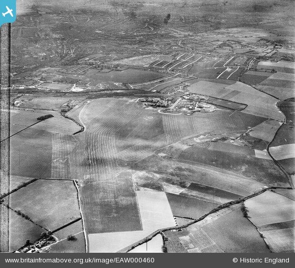
EAW000460 ENGLAND (1946). Luton Airport and environs, Luton, from the south-east, 1946
© Hawlfraint cyfranwyr OpenStreetMap a thrwyddedwyd gan yr OpenStreetMap Foundation. 2026. Trwyddedir y gartograffeg fel CC BY-SA.
Delweddau cyfagos (3)
EAW000460

EAW000461

EAW000462

Manylion
| Pennawd | [EAW000460] Luton Airport and environs, Luton, from the south-east, 1946 |
| Cyfeirnod | EAW000460 |
| Dyddiad | 3-May-1946 |
| Dolen | |
| Enw lle | LUTON |
| Plwyf | |
| Ardal | |
| Gwlad | ENGLAND |
| Dwyreiniad / Gogleddiad | 512672, 221033 |
| Hydred / Lledred | -0.36306762774707, 51.876029124493 |
| Cyfeirnod Grid Cenedlaethol | TL127210 |
Pinnau

SteveLV |
Friday 15th of November 2013 11:36:12 AM | |
|
SteveLV |
Friday 15th of November 2013 11:34:41 AM | |
|
SteveLV |
Friday 15th of November 2013 11:33:04 AM |