Skip to main content
Prydain oddi Fry
Cymraeg
|
English
Mewngofnod
|
Cofrestru
Toggle navigation
Hafan
Gwaddol
Ynghylch
Map
Orielau
Grwpiau
Cymorth
Chwilio
Pob Gwlad (96344)
Lloegr (82521)
Yr Alban (6398)
Cymru (4321)
Gweddill y Byd (3104)
Gwlad Belg (7)
Ffrainc (27)
yr Almaen (2)
Guernsey (116)
Iran (8)
Irac (6)
Iwerddon (1466)
Ynys Manaw (75)
Jersey (122)
yr Iseldiroedd (20)
Northern Ireland (1163)
Sbaen (9)
y Swisdir (26)
Featured Gallery - Images with damaged negatives
All Galleries
Pagination
First page
first
Previous page
previous
…
Tudalen
119
Tudalen
120
Tudalen
121
Tudalen
122
Current page
123
Tudalen
124
Tudalen
125
Tudalen
126
Tudalen
127
…
Next page
next
Last page
last
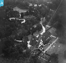
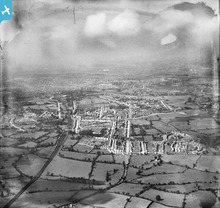
Sefton, St George's Hill, 1938. This image has b...
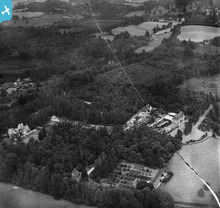
Stilemans, Northanger and Larchwood, Munstead He...
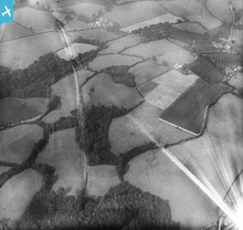
Fields between Gill Wood and Peter's Green, Bodi...
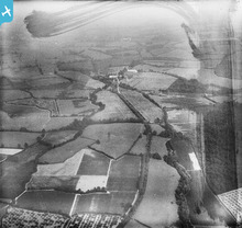
The Rother Light Railway Line adjacent to...
Residential area off Kitt's Green Road, Gills...
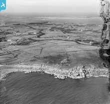
Salakee Down and the island beyond, St Mary's, ...
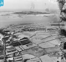
The aerodrome on Carn Morval Down and Tresco beyo...
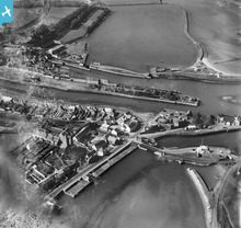
The harbour, quayside and Carnsew Pond, Hayle...
Pagination
First page
first
Previous page
previous
…
Tudalen
119
Tudalen
120
Tudalen
121
Tudalen
122
Current page
123
Tudalen
124
Tudalen
125
Tudalen
126
Tudalen
127
…
Next page
next
Last page
last