
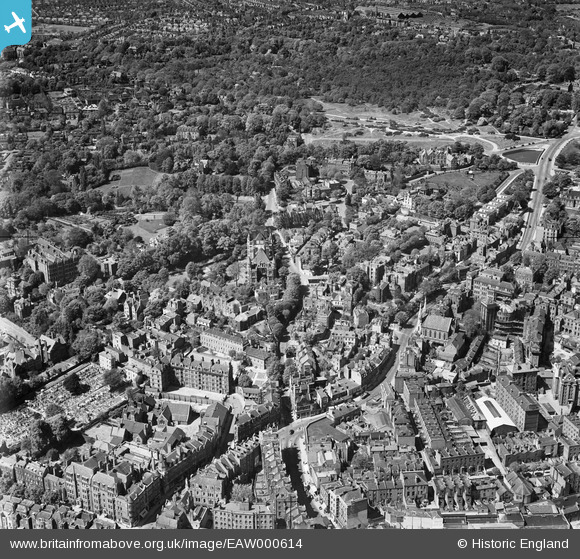
EAW000614 ENGLAND (1946). Heath Street, Holly Hill and West Heath, Hampstead, 1946
© Copyright OpenStreetMap contributors and licensed by the OpenStreetMap Foundation. 2024. Cartography is licensed as CC BY-SA.
Nearby Images (16)
EAW000614

EPW056831

EAW014553

EPW056832

EAW015167

EPW056830

EAW015166

EAW000625

EPW057007

EPW057006

EAW015168

EAW014551

EAW000611

EPW056656

EPW056651

EAW000613

Details
| Title | [EAW000614] Heath Street, Holly Hill and West Heath, Hampstead, 1946 |
| Reference | EAW000614 |
| Date | 10-May-1946 |
| Link | |
| Place name | HAMPSTEAD |
| Parish | |
| District | |
| Country | ENGLAND |
| Easting / Northing | 526232, 185946 |
| Longitude / Latitude | -0.17888152591077, 51.557776520399 |
| National Grid Reference | TQ262859 |


