
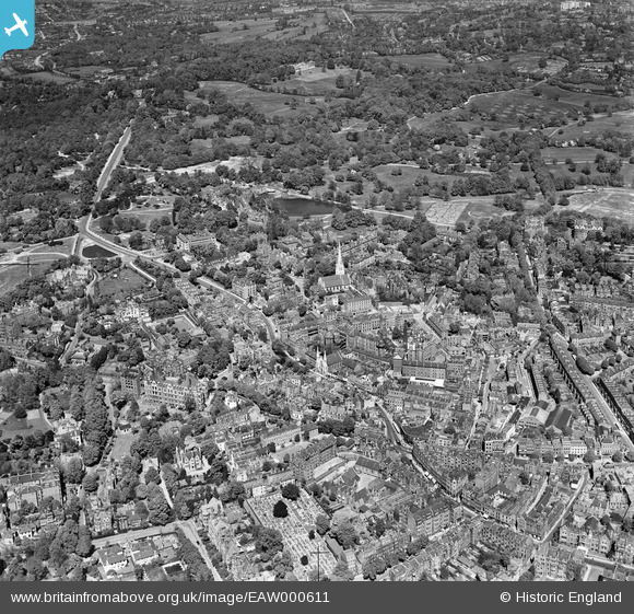
EAW000611 ENGLAND (1946). Christ Church, Heath Street and Hampstead Heath, Hampstead, 1946
© Copyright OpenStreetMap contributors and licensed by the OpenStreetMap Foundation. 2024. Cartography is licensed as CC BY-SA.
Nearby Images (17)
EAW000611

EAW000613

EAW014551

EPW056656

EAW000625

EAW000610

EAW014553

EPW011417

EPW056831

EPW056830

EAW000614

EPW056651

EPW057007

EPW056833

EPW056655

EPW028170

EPW026949

Details
| Title | [EAW000611] Christ Church, Heath Street and Hampstead Heath, Hampstead, 1946 |
| Reference | EAW000611 |
| Date | 10-May-1946 |
| Link | |
| Place name | HAMPSTEAD |
| Parish | |
| District | |
| Country | ENGLAND |
| Easting / Northing | 526441, 186061 |
| Longitude / Latitude | -0.17582661350681, 51.558763305415 |
| National Grid Reference | TQ264861 |
Pins
 Class31 |
Tuesday 19th of May 2015 07:42:28 AM | |
 S Hope |
Thursday 7th of November 2013 03:53:26 PM | |
S Hope |
Thursday 7th of November 2013 03:52:10 PM | |
S Hope |
Thursday 7th of November 2013 03:50:52 PM | |
S Hope |
Thursday 7th of November 2013 03:50:11 PM |


