
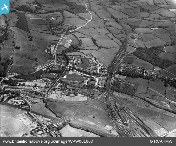
WPW061603 WALES (1939). General view of Pontypool, oblique aerial view. 5"x4" black and white glass plate negative.
© Copyright OpenStreetMap contributors and licensed by the OpenStreetMap Foundation. 2026. Cartography is licensed as CC BY-SA.
Nearby Images (9)
WPW061596

WPW061600

WPW061601

WPW061602

WPW061603

WPW061604

WPW061605

WPW061606

WPW061607

Details
| Title | [WPW061603] General view of Pontypool, oblique aerial view. 5"x4" black and white glass plate negative. |
| Reference | WPW061603 |
| Date | 1939 |
| Link | Coflein Archive Item 6370516 |
| Place name | |
| Parish | |
| District | |
| Country | WALES |
| Easting / Northing | 328300, 200000 |
| Longitude / Latitude | -3.0374677788042, 51.693705054633 |
| National Grid Reference | SO283000 |
Pins

Jilly |
Wednesday 22nd of August 2012 09:00:45 PM | |
|
Bloodthorn |
Wednesday 27th of June 2012 10:53:40 PM | |
|
Bloodthorn |
Wednesday 27th of June 2012 10:52:16 PM | |
|
Bloodthorn |
Wednesday 27th of June 2012 10:51:16 PM | |
|
Bloodthorn |
Wednesday 27th of June 2012 10:50:30 PM | |
|
Bloodthorn |
Wednesday 27th of June 2012 10:49:24 PM | |
|
Bloodthorn |
Wednesday 27th of June 2012 10:48:41 PM | |
|
Bloodthorn |
Wednesday 27th of June 2012 10:48:15 PM | |
|
Bloodthorn |
Wednesday 27th of June 2012 10:47:44 PM | |
|
Bloodthorn |
Wednesday 27th of June 2012 10:47:24 PM | |
|
Bloodthorn |
Wednesday 27th of June 2012 10:46:54 PM | |
|
Bloodthorn |
Wednesday 27th of June 2012 10:46:32 PM | |
|
Bloodthorn |
Wednesday 27th of June 2012 10:45:54 PM | |
|
Bloodthorn |
Wednesday 27th of June 2012 11:15:46 AM | |
|
Bloodthorn |
Wednesday 27th of June 2012 11:15:00 AM | |
|
Bloodthorn |
Wednesday 27th of June 2012 11:12:33 AM |