
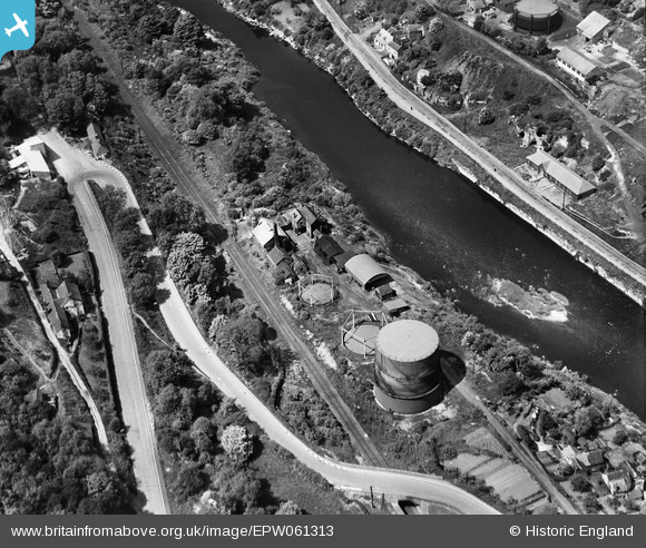
EPW061313 ENGLAND (1939). The town Gas Works alongside the River Severn and Ironbridge Road, Ironbridge, 1939
© Copyright OpenStreetMap contributors and licensed by the OpenStreetMap Foundation. 2026. Cartography is licensed as CC BY-SA.
Nearby Images (13)
EPW061313

EPW061308

EPW061314

EPW061312

EAW012672

EAW012587

EPW061310

EPW061311

EPW061307

EPW061309

EPW034285

EPW046396

EPW046397

Details
| Title | [EPW061313] The town Gas Works alongside the River Severn and Ironbridge Road, Ironbridge, 1939 |
| Reference | EPW061313 |
| Date | 31-May-1939 |
| Link | |
| Place name | IRONBRIDGE |
| Parish | THE GORGE |
| District | |
| Country | ENGLAND |
| Easting / Northing | 367845, 303248 |
| Longitude / Latitude | -2.4750851345114, 52.625686926572 |
| National Grid Reference | SJ678032 |
Pins
Be the first to add a comment to this image!
User Comment Contributions
Broseley Gas Works |

steve dewhirst |
Thursday 7th of November 2013 08:08:21 PM |