
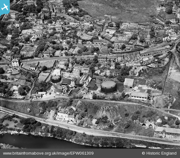
EPW061309 ENGLAND (1939). The town Gas Works alongside Madeley Road, Ironbridge, 1939
© Copyright OpenStreetMap contributors and licensed by the OpenStreetMap Foundation. 2026. Cartography is licensed as CC BY-SA.
Nearby Images (10)
EPW061309

EPW061311

EPW061307

EPW061310

EPW034285

EPW061312

EAW012672

EPW061313

EPW061308

EPW061314

Details
| Title | [EPW061309] The town Gas Works alongside Madeley Road, Ironbridge, 1939 |
| Reference | EPW061309 |
| Date | 31-May-1939 |
| Link | |
| Place name | IRONBRIDGE |
| Parish | THE GORGE |
| District | |
| Country | ENGLAND |
| Easting / Northing | 367747, 303429 |
| Longitude / Latitude | -2.4765506908154, 52.627308387588 |
| National Grid Reference | SJ677034 |
Pins
Be the first to add a comment to this image!
User Comment Contributions
Prospect House |

severnsider |
Wednesday 18th of November 2015 02:47:34 PM |
Postal Sorting Office and Ironbridge OAP Fellowship Hut (Tarver's) |
severnsider |
Wednesday 18th of November 2015 02:47:02 PM |