
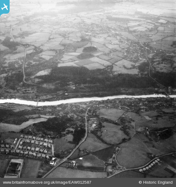
EAW012587 ENGLAND (1948). The River Severn in flood, Ironbridge, 1948
© Copyright OpenStreetMap contributors and licensed by the OpenStreetMap Foundation. 2026. Cartography is licensed as CC BY-SA.
Nearby Images (7)
EAW012587

EPW061313

EPW061314

EPW061312

EPW061308

EAW012672

EPW061310

Details
| Title | [EAW012587] The River Severn in flood, Ironbridge, 1948 |
| Reference | EAW012587 |
| Date | 14-January-1948 |
| Link | |
| Place name | IRONBRIDGE |
| Parish | THE GORGE |
| District | |
| Country | ENGLAND |
| Easting / Northing | 367708, 303165 |
| Longitude / Latitude | -2.4771010972663, 52.624932583603 |
| National Grid Reference | SJ677032 |
Pins

severnsider |
Wednesday 18th of November 2015 02:57:28 PM |