
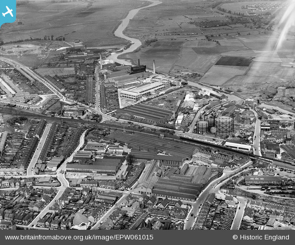
EPW061015 ENGLAND (1939). J. and E. Hall Ltd Engineering Works, Dartford, 1939
© Copyright OpenStreetMap contributors and licensed by the OpenStreetMap Foundation. 2026. Cartography is licensed as CC BY-SA.
Nearby Images (20)
EPW061015

EPW061013

EPW061006

EPW061011

EPW021982

EPR000367

EPW021980

EPW021979

EPW010894

EPW061012

EPW021977

EAW013644

EAW013652

EAW013646

EAW013645

EPW010895

EAW013651

EAW013647

EPW061007

EPW061008

Details
| Title | [EPW061015] J. and E. Hall Ltd Engineering Works, Dartford, 1939 |
| Reference | EPW061015 |
| Date | 22-May-1939 |
| Link | |
| Place name | DARTFORD |
| Parish | |
| District | |
| Country | ENGLAND |
| Easting / Northing | 553999, 174637 |
| Longitude / Latitude | 0.21647415265753, 51.449259116335 |
| National Grid Reference | TQ540746 |
Pins
Be the first to add a comment to this image!