
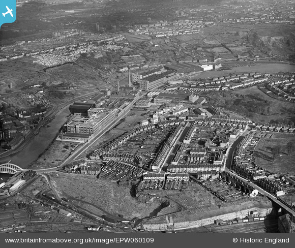
EPW060109 ENGLAND (1938). The St Anne's Board Mill Co Ltd Works and the surrounding residential area, Bristol, 1938
© Copyright OpenStreetMap contributors and licensed by the OpenStreetMap Foundation. 2026. Cartography is licensed as CC BY-SA.
Nearby Images (22)
EPW060109

EPW060105

EPW050468

EPW050470

EPW050567

EPW060114

EPW050561

EPW050566

EPW050572

EPW050469

EPW050562

EPW050559

EPW060113

EPW060110

EPW050465

EPW050564

EPW060111

EPW005538

EPW050565

EPW060112

EPW050571

EPW060106

Details
| Title | [EPW060109] The St Anne's Board Mill Co Ltd Works and the surrounding residential area, Bristol, 1938 |
| Reference | EPW060109 |
| Date | 1-November-1938 |
| Link | |
| Place name | BRISTOL |
| Parish | |
| District | |
| Country | ENGLAND |
| Easting / Northing | 361980, 172701 |
| Longitude / Latitude | -2.5472121827122, 51.451525620928 |
| National Grid Reference | ST620727 |
Pins
Be the first to add a comment to this image!