
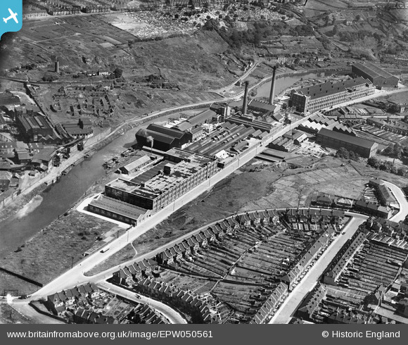
EPW050561 ENGLAND (1936). St Anne's Board Mill Co Ltd Works, Bristol, 1936
© Copyright OpenStreetMap contributors and licensed by the OpenStreetMap Foundation. 2026. Cartography is licensed as CC BY-SA.
Nearby Images (22)
EPW050561

EPW050567

EPW050566

EPW060110

EPW050559

EPW050470

EPW050572

EPW060109

EPW060105

EPW060114

EPW050564

EPW005538

EPW050468

EPW060113

EPW050562

EPW050469

EPW060111

EPW050565

EPW060112

EPW050465

EPW050571

EPW060106

Details
| Title | [EPW050561] St Anne's Board Mill Co Ltd Works, Bristol, 1936 |
| Reference | EPW050561 |
| Date | June-1936 |
| Link | |
| Place name | BRISTOL |
| Parish | |
| District | |
| Country | ENGLAND |
| Easting / Northing | 361918, 172765 |
| Longitude / Latitude | -2.5481113805935, 51.452096951944 |
| National Grid Reference | ST619728 |
Pins

Rob (Troopers) |
Friday 4th of August 2023 12:10:13 PM | |

Class31 |
Monday 11th of May 2015 07:51:29 AM | |

Maurice |
Monday 13th of May 2013 12:43:02 PM | |
|
MB |
Monday 13th of May 2013 10:22:07 AM | |
|
MB |
Monday 13th of May 2013 10:21:50 AM | |
|
MB |
Sunday 12th of May 2013 10:03:41 PM | |
|
MB |
Sunday 12th of May 2013 10:03:22 PM | |
|
MB |
Sunday 12th of May 2013 10:02:36 PM | |
|
MB |
Sunday 12th of May 2013 10:02:00 PM | |
|
MB |
Sunday 12th of May 2013 10:01:41 PM | |
|
MB |
Sunday 12th of May 2013 10:00:24 PM | |
|
MB |
Sunday 12th of May 2013 09:58:14 PM | |
It is. Just ruined walls here, but still standing in 1917 |
MB |
Sunday 12th of May 2013 09:59:48 PM |
|
MB |
Sunday 12th of May 2013 09:56:09 PM | |
|
MB |
Sunday 12th of May 2013 09:55:25 PM | |
|
MB |
Sunday 12th of May 2013 09:53:49 PM | |
|
MB |
Sunday 12th of May 2013 09:53:15 PM | |
|
MB |
Sunday 12th of May 2013 09:52:37 PM | |
|
MB |
Sunday 12th of May 2013 09:52:13 PM |
