
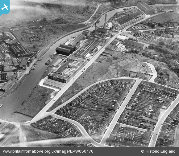
EPW050470 ENGLAND (1936). St Anne's Board Mill Co Ltd Works and environs, Bristol, 1936
© Copyright OpenStreetMap contributors and licensed by the OpenStreetMap Foundation. 2026. Cartography is licensed as CC BY-SA.
Nearby Images (22)
EPW050470

EPW050572

EPW050559

EPW050567

EPW050561

EPW060109

EPW050566

EPW050564

EPW060110

EPW060105

EPW050468

EPW060114

EPW050562

EPW050469

EPW060113

EPW005538

EPW060111

EPW050465

EPW050565

EPW060112

EPW050571

EPW060106

Details
| Title | [EPW050470] St Anne's Board Mill Co Ltd Works and environs, Bristol, 1936 |
| Reference | EPW050470 |
| Date | June-1936 |
| Link | |
| Place name | BRISTOL |
| Parish | |
| District | |
| Country | ENGLAND |
| Easting / Northing | 361911, 172703 |
| Longitude / Latitude | -2.5482054487187, 51.451538966466 |
| National Grid Reference | ST619727 |


