
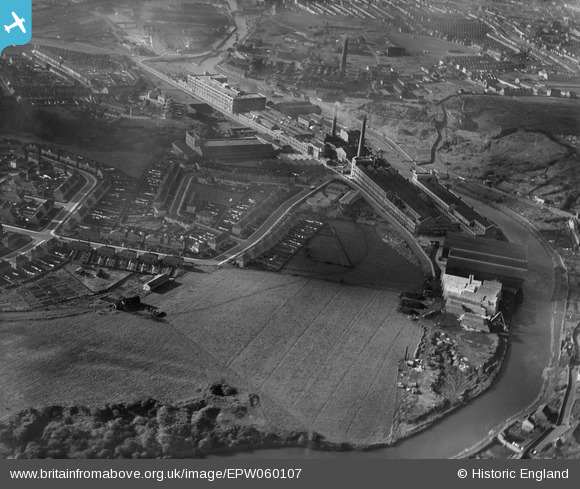
EPW060107 ENGLAND (1938). The St Anne's Board Mill Co Ltd Works, Bristol, 1938
© Copyright OpenStreetMap contributors and licensed by the OpenStreetMap Foundation. 2026. Cartography is licensed as CC BY-SA.
Nearby Images (20)
EPW060107

EPW050557

EPW060108

EPW060115

EPW050467

EPW050560

EPW050463

EPW050466

EPW050569

EPW050570

EPW050558

EPW050568

EPW050571

EPW060106

EPW050464

EPW060112

EPW050565

EPW050465

EPW060111

EPW050563

Details
| Title | [EPW060107] The St Anne's Board Mill Co Ltd Works, Bristol, 1938 |
| Reference | EPW060107 |
| Date | 1-November-1938 |
| Link | |
| Place name | BRISTOL |
| Parish | |
| District | |
| Country | ENGLAND |
| Easting / Northing | 362352, 172876 |
| Longitude / Latitude | -2.5418769699111, 51.453124116326 |
| National Grid Reference | ST624729 |
Pins
Be the first to add a comment to this image!