
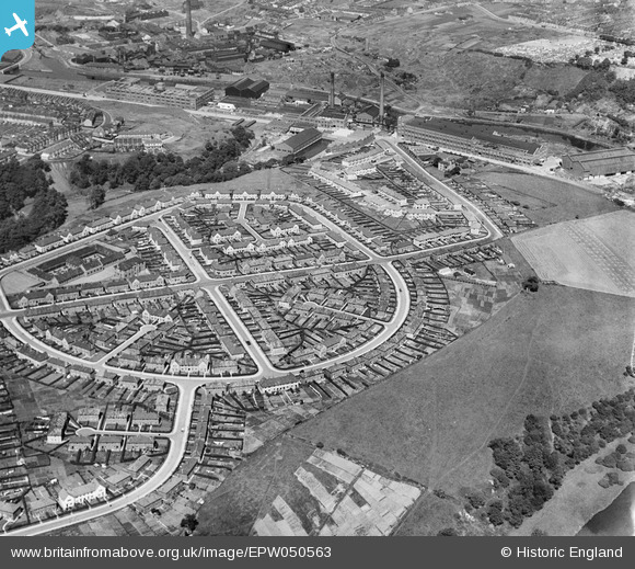
EPW050563 ENGLAND (1936). Housing at St Anne's Park and environs, Bristol, 1936
© Copyright OpenStreetMap contributors and licensed by the OpenStreetMap Foundation. 2026. Cartography is licensed as CC BY-SA.
Nearby Images (9)
EPW050563

EPW050464

EPW050560

EPW050467

EPW050558

EPW048311

EPW060108

EPW060107

EPW050557

Details
| Title | [EPW050563] Housing at St Anne's Park and environs, Bristol, 1936 |
| Reference | EPW050563 |
| Date | June-1936 |
| Link | |
| Place name | BRISTOL |
| Parish | |
| District | |
| Country | ENGLAND |
| Easting / Northing | 362467, 172629 |
| Longitude / Latitude | -2.5401956118329, 51.450910685199 |
| National Grid Reference | ST625726 |
Pins

Alan |
Monday 15th of December 2014 11:26:03 PM |