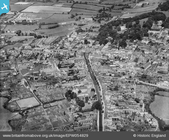
EPW054829 ENGLAND (1937). South Street and the town, Bridport, 1937
© Copyright OpenStreetMap contributors and licensed by the OpenStreetMap Foundation. 2026. Cartography is licensed as CC BY-SA.
Nearby Images (13)
EPW054829

EPW024177

EPW024042

EPW013517

EPW024040

EPW013519

EPW054828

EPW013516

EPW013518

EPW024043

EPW024044

EPW024045

EPW013522

Details
| Title | [EPW054829] South Street and the town, Bridport, 1937 |
| Reference | EPW054829 |
| Date | August-1937 |
| Link | |
| Place name | BRIDPORT |
| Parish | BRIDPORT |
| District | |
| Country | ENGLAND |
| Easting / Northing | 346573, 92803 |
| Longitude / Latitude | -2.7571191486307, 50.731811262396 |
| National Grid Reference | SY466928 |