
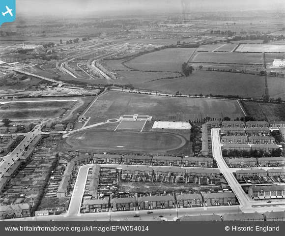
EPW054014 ENGLAND (1937). Southall Municipal Sports Ground and environs, Southall, from the east, 1937
© Copyright OpenStreetMap contributors and licensed by the OpenStreetMap Foundation. 2025. Cartography is licensed as CC BY-SA.
Nearby Images (7)
EPW054014

EPW054016

EPW054020

EPW054015

EPW054018

EPW054017

EPW054013

Details
| Title | [EPW054014] Southall Municipal Sports Ground and environs, Southall, from the east, 1937 |
| Reference | EPW054014 |
| Date | June-1937 |
| Link | |
| Place name | SOUTHALL |
| Parish | |
| District | |
| Country | ENGLAND |
| Easting / Northing | 512636, 181113 |
| Longitude / Latitude | -0.37648455100757, 51.517212951066 |
| National Grid Reference | TQ126811 |
Pins

Mozzy |
Monday 31st of October 2016 07:29:59 PM | |
|
Mozzy |
Saturday 27th of December 2014 06:12:18 PM | |
|
southallboy |
Wednesday 14th of August 2013 01:17:21 PM |
User Comment Contributions
The greeting card factory was called Wilson Brothers. |
Neil Desperandum |
Thursday 30th of January 2014 09:52:48 PM |