
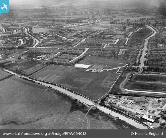
EPW054013 ENGLAND (1937). The Paddington Branch of the Grand Union Canal, Southall Municipal Sports Ground and environs, Southall, from the west, 1937
© Copyright OpenStreetMap contributors and licensed by the OpenStreetMap Foundation. 2025. Cartography is licensed as CC BY-SA.
Nearby Images (7)
EPW054013

EPW054019

EPW054015

EPW054020

EPW054018

EPW054016

EPW054014

Details
| Title | [EPW054013] The Paddington Branch of the Grand Union Canal, Southall Municipal Sports Ground and environs, Southall, from the west, 1937 |
| Reference | EPW054013 |
| Date | June-1937 |
| Link | |
| Place name | SOUTHALL |
| Parish | |
| District | |
| Country | ENGLAND |
| Easting / Northing | 512423, 181173 |
| Longitude / Latitude | -0.37953422950746, 51.517794723618 |
| National Grid Reference | TQ124812 |
Pins

Mozzy |
Wednesday 10th of March 2021 05:23:36 PM | |
|
Mozzy |
Sunday 9th of February 2020 08:38:11 PM | |

Des Elmes |
Monday 11th of April 2016 02:40:39 AM | |
|
Des Elmes |
Monday 11th of April 2016 02:38:56 AM | |
|
Mozzy |
Saturday 27th of December 2014 08:07:38 PM | |
|
Mozzy |
Saturday 27th of December 2014 08:06:44 PM | |
|
Mike |
Thursday 24th of July 2014 06:06:52 PM | |
|
Gordon Wilson |
Monday 16th of September 2013 09:33:03 PM | |
|
Gordon Wilson |
Monday 12th of August 2013 10:15:14 PM |