
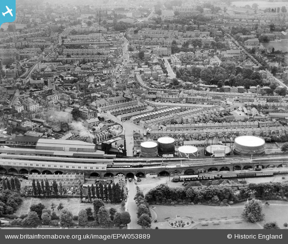
EPW053889 ENGLAND (1937). The railway station, gas works and the town, Windsor, from the north, 1937
© Copyright OpenStreetMap contributors and licensed by the OpenStreetMap Foundation. 2026. Cartography is licensed as CC BY-SA.
Nearby Images (10)
EPW053889

EAW003702

EAW003782

EAW052999

EPW056587

EAW042131

EPW056588

EPW001599

EPW047391

EAW003783

Details
| Title | [EPW053889] The railway station, gas works and the town, Windsor, from the north, 1937 |
| Reference | EPW053889 |
| Date | 25-June-1937 |
| Link | |
| Place name | WINDSOR |
| Parish | |
| District | |
| Country | ENGLAND |
| Easting / Northing | 496505, 176890 |
| Longitude / Latitude | -0.61006962496864, 51.482235730928 |
| National Grid Reference | SU965769 |
Pins

dave43 |
Monday 1st of July 2019 08:48:49 PM | |
|
adamtunstall |
Wednesday 29th of November 2017 03:59:33 PM | |
|
John Wass |
Sunday 8th of February 2015 04:18:52 PM | |
|
Thamesweb |
Friday 5th of July 2013 01:46:21 PM | |
|
Thamesweb |
Friday 5th of July 2013 01:44:27 PM |