
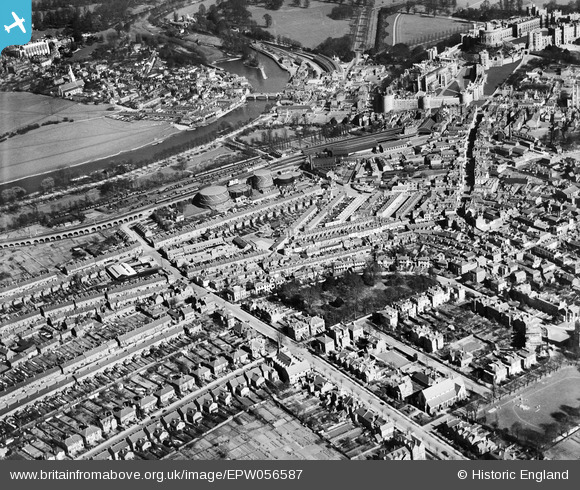
EPW056587 ENGLAND (1938). The town centre with Windsor Castle in the background, Windsor, 1938
© Copyright OpenStreetMap contributors and licensed by the OpenStreetMap Foundation. 2026. Cartography is licensed as CC BY-SA.
Nearby Images (7)
EPW056587

EAW003782

EAW003702

EPW053889

EAW052999

EPW056588

EAW042131

Details
| Title | [EPW056587] The town centre with Windsor Castle in the background, Windsor, 1938 |
| Reference | EPW056587 |
| Date | March-1938 |
| Link | |
| Place name | WINDSOR |
| Parish | |
| District | |
| Country | ENGLAND |
| Easting / Northing | 496371, 176793 |
| Longitude / Latitude | -0.61202545056789, 51.481386564619 |
| National Grid Reference | SU964768 |
Pins

John W |
Tuesday 4th of October 2016 07:20:51 PM | |
|
John W |
Tuesday 4th of October 2016 07:19:16 PM | |
|
Thamesweb |
Saturday 22nd of August 2015 11:02:45 PM | |
|
Ellensdottir |
Sunday 10th of November 2013 03:38:49 PM | |
|
Ellensdottir |
Sunday 10th of November 2013 03:38:11 PM | |
|
Ellensdottir |
Sunday 10th of November 2013 03:36:31 PM | |
|
Ellensdottir |
Sunday 10th of November 2013 03:36:02 PM | |
|
Ellensdottir |
Saturday 9th of November 2013 09:05:56 PM | |

Alan McFaden |
Tuesday 9th of July 2013 06:40:18 PM | |
|
Thamesweb |
Friday 5th of July 2013 01:29:44 PM | |
Gas light and coke co. 'The goswells' |
Ellensdottir |
Sunday 10th of November 2013 03:34:23 PM |
|
Thamesweb |
Friday 5th of July 2013 01:28:06 PM | |
|
Thamesweb |
Friday 5th of July 2013 01:26:27 PM | |
|
Thamesweb |
Friday 5th of July 2013 01:26:26 PM | |
|
Thamesweb |
Friday 5th of July 2013 01:24:35 PM |

User Comment Contributions

Windsor and Eton Riverside Railway Station |
Alan McFaden |
Saturday 8th of November 2014 10:42:09 AM |

Windsor and Eton Central Railway Station |
Alan McFaden |
Saturday 8th of November 2014 10:41:28 AM |