
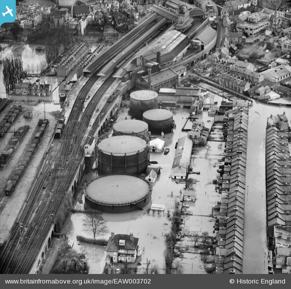
EAW003702 ENGLAND (1947). Flooding around the town Gas Works and the Central Railway Station, Windsor, 1947
© Copyright OpenStreetMap contributors and licensed by the OpenStreetMap Foundation. 2026. Cartography is licensed as CC BY-SA.
Nearby Images (9)
EAW003702

EAW003782

EPW053889

EPW056587

EAW042131

EAW052999

EAW003783

EPW056588

EPW001599

Details
| Title | [EAW003702] Flooding around the town Gas Works and the Central Railway Station, Windsor, 1947 |
| Reference | EAW003702 |
| Date | 18-March-1947 |
| Link | |
| Place name | WINDSOR |
| Parish | |
| District | |
| Country | ENGLAND |
| Easting / Northing | 496451, 176926 |
| Longitude / Latitude | -0.61083728890914, 51.482568580306 |
| National Grid Reference | SU965769 |
Pins

Thamesweb |
Thursday 16th of March 2017 08:06:11 PM | |
|
David Gosling |
Saturday 26th of April 2014 09:46:13 PM | |
Strictly speaking this area is known as The Goswells. Alexandra Gardens is to the left (west) of this view. |
Thamesweb |
Saturday 26th of July 2014 02:23:47 PM |
|
David Gosling |
Saturday 26th of April 2014 09:44:24 PM | |
|
dave43 |
Monday 9th of September 2013 10:32:28 PM |