
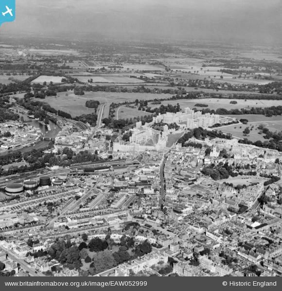
EAW052999 ENGLAND (1953). Windsor Castle and the town, Windsor, from the south-west, 1953
© Copyright OpenStreetMap contributors and licensed by the OpenStreetMap Foundation. 2026. Cartography is licensed as CC BY-SA.
Nearby Images (9)
EAW052999

EPW056588

EPW053889

EPW056587

EAW003702

EAW003782

EPW037034

EPR000458

EPW047391

Details
| Title | [EAW052999] Windsor Castle and the town, Windsor, from the south-west, 1953 |
| Reference | EAW052999 |
| Date | 19-November-1953 |
| Link | |
| Place name | WINDSOR |
| Parish | |
| District | |
| Country | ENGLAND |
| Easting / Northing | 496536, 176753 |
| Longitude / Latitude | -0.60966074121894, 51.480998825168 |
| National Grid Reference | SU965768 |
Pins
Be the first to add a comment to this image!
User Comment Contributions

Windsor and Eton Riverside Station |

Alan McFaden |
Saturday 8th of November 2014 09:27:05 AM |

Windsor and Eton Central Railway Station |
Alan McFaden |
Saturday 8th of November 2014 09:26:14 AM |

Windsor Castle |
Alan McFaden |
Saturday 8th of November 2014 09:25:15 AM |