
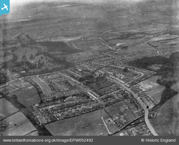
EPW052492 ENGLAND (1937). Housing around Addington Road and environs, Selsdon, 1937. This image has been produced from a print.
© Copyright OpenStreetMap contributors and licensed by the OpenStreetMap Foundation. 2026. Cartography is licensed as CC BY-SA.
Nearby Images (21)
EPW052492

EPW026623

EPW052491

EPW026625

EPW052499

EPW026617

EPW015891

EPW015876

EPW015884

EPW015883

EPW052481

EPW015887

EPW052480

EPW026621

EPW052497

EPW052493

EPW026626

EPW026622

EPW026616

EPW015880

EPW026620

Details
| Title | [EPW052492] Housing around Addington Road and environs, Selsdon, 1937. This image has been produced from a print. |
| Reference | EPW052492 |
| Date | 22-February-1937 |
| Link | |
| Place name | SELSDON |
| Parish | |
| District | |
| Country | ENGLAND |
| Easting / Northing | 535075, 162335 |
| Longitude / Latitude | -0.060398112116732, 51.343526413143 |
| National Grid Reference | TQ351623 |
Pins
Be the first to add a comment to this image!