
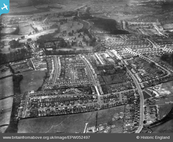
EPW052497 ENGLAND (1937). Housing around Sundale Avenue and environs, Selsdon, 1937. This image has been produced from a print.
© Copyright OpenStreetMap contributors and licensed by the OpenStreetMap Foundation. 2026. Cartography is licensed as CC BY-SA.
Nearby Images (9)
EPW052497

EPW026617

EPW015876

EPW052499

EPW026625

EPW026623

EPW052492

EPW052487

EPW052491

Details
| Title | [EPW052497] Housing around Sundale Avenue and environs, Selsdon, 1937. This image has been produced from a print. |
| Reference | EPW052497 |
| Date | 22-February-1937 |
| Link | |
| Place name | SELSDON |
| Parish | |
| District | |
| Country | ENGLAND |
| Easting / Northing | 535286, 162250 |
| Longitude / Latitude | -0.057402446101541, 51.342712279084 |
| National Grid Reference | TQ353623 |
Pins

HistoryBuff61 |
Tuesday 2nd of February 2021 08:58:56 AM | |
|
DaveSev |
Wednesday 19th of November 2014 07:06:29 PM | |
|
Andy Burton |
Friday 31st of October 2014 02:48:04 PM |